Evacuation shelter information
Clackamas Community College
Gregory Forum
19600 Molalla Ave, Oregon City
Open 24/7 through the duration of the flooding event
Pets and service animals welcome
Flooding evacuation notices
Updated: 12/18 at 9:17 p.m.
A Level 1 (Be Ready) evacuation notice has been issued for low-lying areas along Johnson Creek within Clackamas County and the City of Milwaukie.
A Level 2 (Be Set) evacuation notice has been issued for SE Paradise Road, SE Woods Road, and SE Starr Road southwest of the community of Eagle Creek.
A Level 2 (Be Set) evacuation notice has also been issued for Carver Mobile Home Ranch south of Highway 224 in Carver.
A Level 2 (Be Set) evacuation notice has been issued for the area east of South Clark Lane and west of the Clackamas River along South Palmer Road. This area is on the west side of the Clackamas River south of Bonnie Lure State Recreation Area and north of Paradise Park.
A Level 2 (Be Set) evacuation notice has been issued for properties in low-lying areas along Tranquility Drive between S Bakers Ferry Road and the Clackamas River, beginning at 20600 S Tranquility Lane in unincorporated Clackamas County.
A Level 2 (Be Set) evacuation notice has been issued for areas between SE Dowty Road and Eagle Creek south of the bridge over Eagle Creek at the Bonnie Lure State Recreation Area and north of 24370 SE Dowty Road. Also includes properties along the north side of Eagle Creek west of Dowty Road at the end of SE Blay Road.
A Level 2 (Be Set) evacuation notice has been issued for low-lying areas along the north side of the Clackamas River, along SE Semple Road between 197th Avenue and the north end of SE Semple Road.
A Level 2 (Be Set) evacuation notice has been issued for areas along the Clackamas River between approximately 16807 S South Clackamas River Drive north/northeast to 16918 S Clackamas River Drive. The evacuation area is between the river and the access road just west of Cal Farms (17031 S Clackamas River Drive).
A Level 2 (Be Set) evacuation notice has been issued for the area between S Clackamas River Drive and the Clackamas River, between 15751 and 16171 S Clackamas River Dr. It also includes low-lying areas on the north side of the River between SE 130th Avenue west of the Sah-Hah-Lee Golf Course to Beebe Island.
A Level 2 (Be Set) evacuation notice has been issued for low-lying areas along the Clackamas River north of S Clackamas River Drive, east of Interstate 205 to 13605 S Clackamas River Drive.
A Level 1 (Be Ready) evacuation notice has been issued for areas along the Clackamas River between Estacada and Oregon City.
A Level 1 (Be Ready) evacuation notice has been issued for the Edgewater at the Cove apartment complex in Oregon City. This area is along the Clackamas River between Main Street and the Oregon City Shopping Center north of I-205.
A Level 1 (Be Ready) evacuation notice has been issued for 82nd Street Drive in Oregon City. The Level 1 area covers from S Washington Street north to the Clackamas River.
A Level 1 (Be Ready) evacuation notice has been issued for low-lying areas along the Molalla River, Pudding River and Butte Creek.
This means flooding is possible in your area, and you should be ready to leave quickly. Don’t wait to evacuate if you feel unsafe. Conditions can change rapidly. Make the best decision for your safety.
For evacuation maps and more, visit our Flooding Preparedness page.
Residents urged to take precautions as potential flooding, strong wind grips region
Disaster can strike at any time. Sign up for emergency alerts from Clackamas County to be informed before, during, and after incidents.
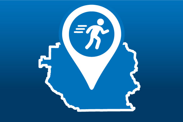
When evacuation orders occur, we will post evacuation levels on this map.
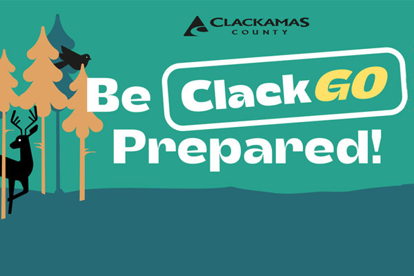
The latest weather information.
Sites with self-service, residential sandbags.
Helpful information from Ready.Gov
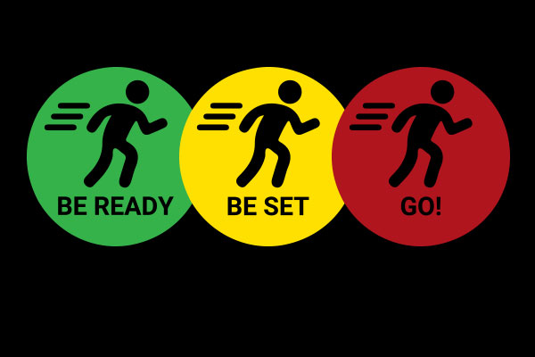
Disasters and emergencies can lead to evacuations. Know the types of evacuation orders that you could experience and make a plan in advance.
Translate


