Translate


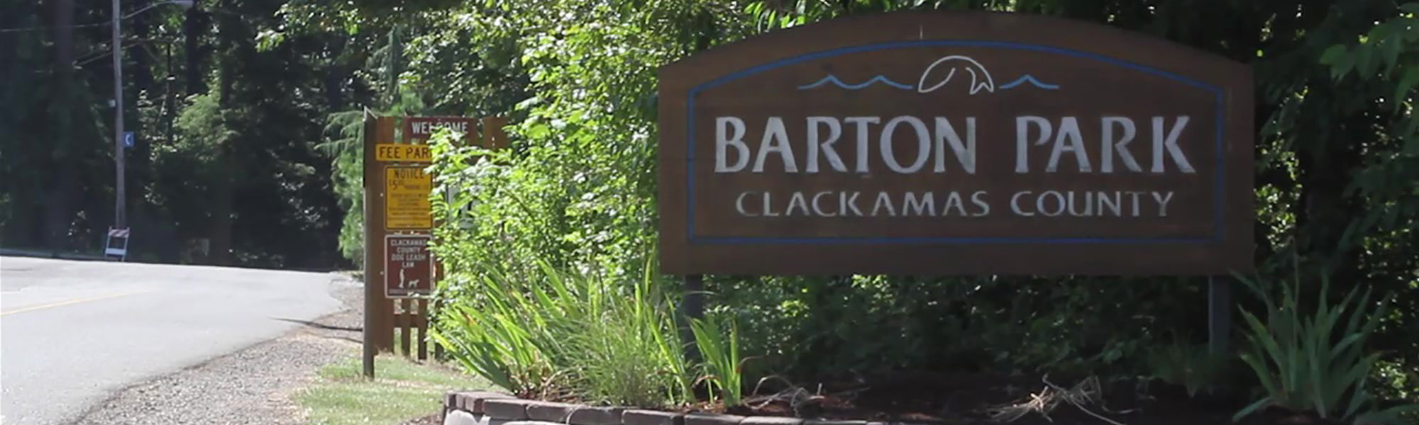

Clackamas County, Metro, community members and parks and recreation stakeholders joined forces to plan the future of Barton Park.
Clackamas County Parks teamed up with Metro and other key stakeholders to create a master plan that addresses public outdoor recreation needs for Barton Park and its associated properties. From expanding park amenities to easing the flow of traffic onsite and in surrounding areas, there are many changes in store that will benefit the community, neighborhood and park users.
Concept planning took place for three undeveloped sites totaling about 49 acres near Barton Park: Cazadero Natural Area, Barton Quarry and the Overlook property. The planning process, which was completed in summer 2020, will enhance the existing park to meet the needs of the public and ensure the undeveloped sites reflect community values.
About the Barton Park Complex
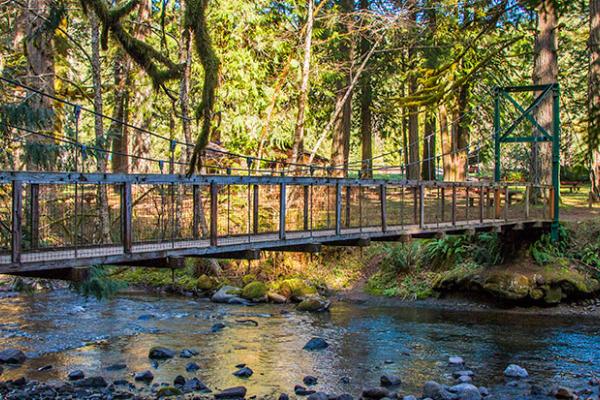
Barton Park is located on the Clackamas River just off of Highway 224, approximately four miles south of the unincorporated community of Boring. Barton Park is the largest and most popular county park, encompassing 122 acres and offering 112 campsites; 103 with water and electric hookups. Other park and recreational amenities include playground equipment, horseshoe pits, two volleyball courts, five picnic shelters, other picnic areas, a softball field and one boat ramp on the Clackamas River. Barton Park is a popular rafting destination due to its proximity to Portland and connection to the Carver Boat launch approximately six miles downstream.
Project Goals
- Develop a community-supported master plan that provides guidance for future expansion of Barton Park
- Prepare a master plan that strengthens the connection between Barton Park and Carver Park, and that integrates the disparate Barton Park Complex parcels of land
- Consider:
- Habitat conservation objectives and/or impacts
- The park’s designation as a Temporary Debris Storage and Reduction Site – an area designated to temporarily store, sort and manage debris following an event such as a wind storm, flooding or earthquake
- Functionality of the transportation system to and within Barton Park as well as traffic operations and intersection safety at key locations
- Connect Barton Park to the regional trail network and improve access to the future Cazadero Trail
Project Study Areas
Undeveloped sites to be planned
Barton Quarry
The Barton Quarry is a 19.14-acre former surface mining site and rock quarry that has been owned by the Clackamas County Department of Transportation and Development and will be transferred to Clackamas County Park’s ownership. The Quarry, located northeast of the Barton Park RV campground, consists of two tax lots and includes a four-acre excavation/infiltration pond that was used to contain stormwater. Material extraction has not occurred since 2000 and reclamation is substantially complete. Site restoration work included backfilling, contouring and re-vegetation. Previous on-site inspection reports indicates that the Department of Geology and Mineral Industries (DOGAMI) supports future master planning efforts and the ultimate conversion to recreational use. The original DOGAMI Reclamation Plan states that recreation/park use is the “planned post-mining beneficial use” of the surface mining area.
Barton Stockpile Site
The Barton Stockpile site is and will continue to be a Clackamas County Department of Transportation and Development maintenance facility, located south of the Cazadero Natural Area. The site includes accessory buildings for road maintenance equipment; sand and gravel stockpiles for construction and maintenance, fuel storage tanks, and surface parking areas for equipment storage and vehicle maneuvering. DTD plans to retain the Barton Stockpile Site for ongoing road maintenance operations. This site will not be integrated into the Barton Park Complex.
Barton-Carver Connection
The Clackamas River is one of the premier fishing, rafting and kayaking locations in the region. The Barton Park to Carver Park section of the Clackamas River is one of the most popular sections due to the gentle river waters and close proximity to Portland. It is not unusual for Barton Park to reach parking capacity during the summer months with rafters and boaters often driving two cars and leaving one at Barton and one at Carver. With limited parking available within the Barton Park complex and as the popularity of water sports continues to grow, the need for a shuttle service or added vehicle parking capacity is apparent.
Cazadero Natural Area
The 24-acre Cazadero Natural Area directly north of Barton Park is bordered by SE Bakers Ferry Road on the west, the future Cazadero Trail on the northeast, and a Barton Park access road to the south. Metro purchased the four tax lots in 2010 with funds from the 2006 Natural Areas Bond Measure. The property is generally flat and zoned County RRFF-5: Rural Residential Farm Forest 5-Acre, which allows park development only through a conditional use permit process.
Five acres of the Cazadero Natural Area is envisioned as a trailhead for the future 12-mile Cazadero Trail, which will extend the Springwater Corridor multi-use trail from Boring to Estacada. The trailhead would provide public access to a variety of outdoor activities including long-distance touring by bicycle, hiking, bird watching and equestrian activities. When complete, the Cazadero Trail will connect two regionally significant bicycle routes -- the 21-mile Springwater Corridor to the north and the Oregon State Parks Cascading Rivers Scenic Bikeway to the south.
Overlook Property
The Overlook Property is a six-acre semi-wooded area directly east of the existing RV campground. The property, owned by Clackamas County Parks, includes a vacant 1960’s home, a few outbuildings, the park shop and some primitive camping sites. Identifying park uses and determining how to incorporate this site into the larger Barton Park complex is an important next step.
Transportation
Barton Park is accessed from Bakers Ferry Road approximately 1,200 feet south of Highway 224. SE Barton Park Road is the main road through the park and provides access to the day use area and boat launch.
Three small spur roads intersect SE Barton Park Road and provide access to other Barton Park. Complex facilities including the RV Campground, west campground, maintenance facility and gravel pit. The master planning process should consider functionality of the overall transportation system and traffic operations and intersection safety at key locations
Summary of Community Input
From March-April 2020, we heard from nearly 400 people about their hopes and dreams for the future of Barton Park. Thank you to everyone who provided feedback in our online survey.
- 393 people from across the region took the survey
- 50% of respondents said that user experience was the most important principle to guide improvements
- over 87% of respondents were previous Barton Park visitors. Most used the park for day use, floating, and experiencing nature and scenery
- 58% of respondents have floated the Clackamas River
- 64% of respondents said they would be likely to access the Cazadero State Trail from Barton Park
- 41% of those respondents wanted the ability to camp at the Cazadero State Trail, while 34% didn't know
Working Group
The Barton Park Master Plan Working Group guides the development of the master plan by providing technical guidance; reviewing and commenting on materials; and providing input on trailhead and park uses and layouts. The working group includes representatives from Metro, Oregon Parks and Recreation Department, the Eagle Creek Community Planning Organization, Clackamas County Pedestrian-Bikeway Advisory Committee, County Parks Board and other identified stakeholders.
- Meeting #1, May 15, 2019
- Meeting #2, Sept. 30, 2019
- Meeting #3, Feb. 24, 2020
Contact
- Tom Riggs
Interim Parks Manager
503-781-3137
triggs@clackamas.us - Ben Johnson
Project Manager
503-222-5612
benj@greenworkspc.com