 Translate




Clackamas County Shared Streets Project
In June 2025, the Board of Clackamas County Commissioners adopted the Walk Bike Clackamas Plan, the county’s combined bicycle and pedestrian plan which provides a comprehensive, long-term vision for improving walking and biking opportunities in the county for both transportation and recreation.
Read the 2025 Walk Bike Clackamas Plan (PDF)
One of the opportunities to improve walking and biking in the county is to make more connections in our transportation system on residential streets. To do this, the Walk Bike Clackamas Plan recommended creating a Shared Streets Program.
In the urban unincorporated area of Clackamas County, most neighborhood streets were originally constructed without sidewalks. It would take many decades and millions of dollars to build sidewalks along all these streets. Creating a Shared Streets network offers flexible, less expensive options with fewer impacts on the environment.
What are Shared Streets?
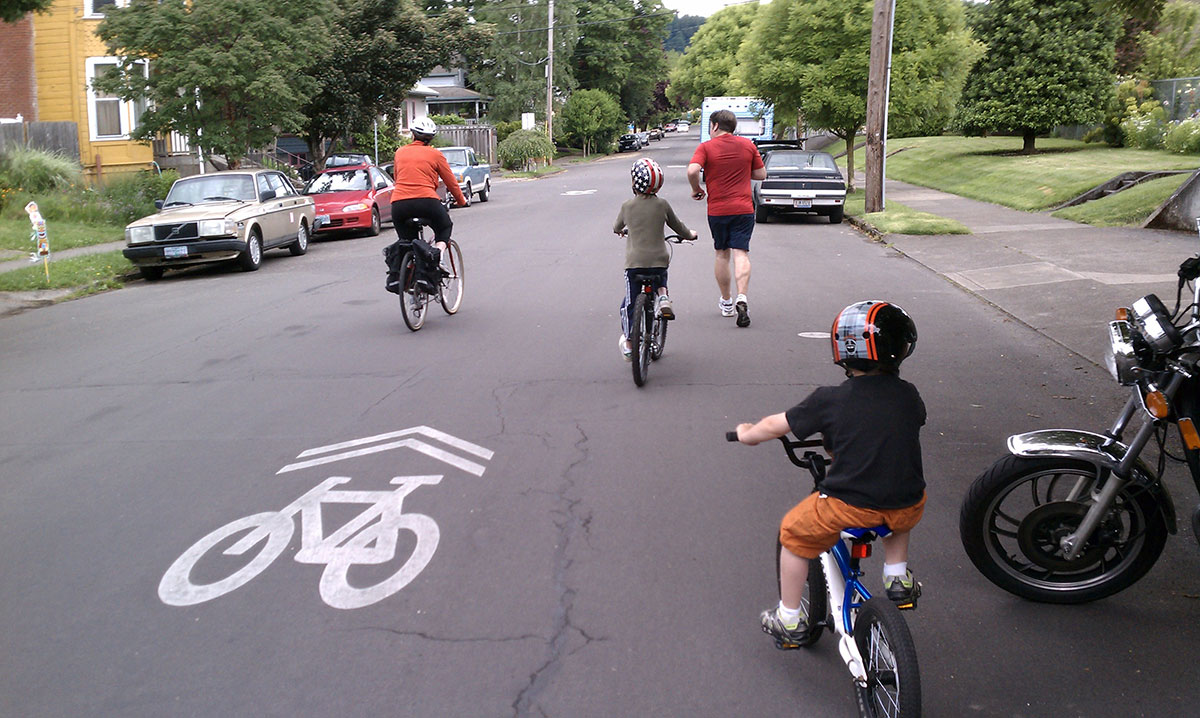
Shared Streets are a quick, low-cost, low-barrier way to create safer, more comfortable places to walk, bike, and roll on low-volume, low-speed residential streets. Shared Streets may include some of the following features:
- Lowered speed limits of 20 MPH
- Pavement markings to communicate the purpose of the Shared Street
- Signage to give roadway users information about the Shared Street and remind drivers to slow down
- Wayfinding signage to point people toward key destinations
- Speed humps to slow drivers down and calm traffic
- Motor vehicle diversion to lower traffic volumes for vehicles while still allowing pedestrians and bicyclists to pass through freely
- Mini traffic circles to reduce speeds and encourage vehicles to use alternate routes
- Narrowing of key points in the roadway to encourage drivers to slow down
- Landscaping and street trees to visually narrow the width of the roadway and encourage traffic to slow down
- Street access to limit where vehicles can enter the street
Which streets are changing?
The Walk Bike Clackamas Plan identified 26 road segments to start a Shared Streets network throughout unincorporated Clackamas County. The segments were identified with a screening process that considered street classification, existing traffic volume, street grid connectivity, connections to destinations, and public comments. Additional locations are expected to be added to the Shared Streets network in the future.
The selected road segments will be analyzed for safety improvements, then engineering design concepts will be considered and prioritized for construction. Expect a list of proposed safety improvements in mid-2027 and a schedule for construction in December 2027. Select street segments may include opportunities for community feedback if vehicle diversion is chosen as the appropriate method for traffic calming.
Candidate streets:
- Burma Rd
- Dawn St
- SE River Forest Dr / SE River Forest Ct / SE River Forest Rd
- SE Laurie Ave
- SE Creighton Ave
- SE Swain Ave SE
- SE Risley Ave SE
- SE Maple St
- SE Chestnut St / SE Pine Ln
- SE Briggs St
- SE Pinehurst Ave
- SE Robin Rd
- SE Harold Ave
- SE Roethe Rd
- SE Cordova Ct / SE Norma Rd
- SE Anna Eve Dr / SE Brewster Pl
- SE Boardman Ave
- SE Addie St
- SE Hull Ave
- SE Cypress Ave
- SE Orchid Ave
- SE Lamphier St
- SE Spencer Dr
- SE 92nd Ave / SE Hillcrest Rd
- SE Bluff Dr / SE 128th Ave
- SE Dee St / SE School Ave
Project schedule
The major milestones of this project include:
- Oct. 2026 – Jan. 2027 | Data collection and route assessment: Consultant will track traffic counts and bike and pedestrian activity on road segments.
- Feb. 2027 – Apr. 2027 | Prioritization: Consultant and county staff will develop criteria to rate and prioritize 26 road segments for safety improvements.
- March – Aug. 2027 | Engineering design and engagement: Consultant will offer engineering design concepts for consideration based on level of safety improvements needed and coordinate with jurisdictional partners. Select street segments may include opportunities for community feedback if vehicle diversion is chosen as the appropriate method for traffic calming.
- Sept. 2027 – Dec. 2027 | Adopt updated traffic calming program: Finalize plan and prepare for adoption, scheduled for Dec. 2027.
Contact
Scott Hoelscher
Senior Planner – Multimodal Transportation
503-742-4533
scotthoe@clackamas.us