Transportation Engineering

Transportation Engineering

Rural County Sign Installation Project

One way that has been proven to decrease traffic crashes is to post safety signage alerting travelers to changing conditions ahead. The county has received a grant from ODOT to install over 2,500 curve and stop ahead warning signs throughout unincorporated Clackamas County to improve safety on our roads.

Status: Completed

Schedule: May 2021 – Aug. 2022

Updated: Sept. 11, 2022

Crash reductions associated with addition of curve warning signs (as compared to curves with no curve warning signs), and stop ahead warning signs are as follows: 

  • Curve Warning Signs with Speed: 13% reduction in all fatal and injury causing crashes
  • Chevrons: 20–35% reduction in fatal and injury causing crashes
  • Intersection Warning Signs with Street Name: 22% reduction in overall crashes; 35% reduction in right-angle crashes
  • Stop Ahead Signs: 35% reduction in angle crashes
  • Double Stop Signs: 11% reduction in overall crashes; 55% reduction in angle crashes

The traffic safety team has assessed and determined proper speeds to post at each road segment where curve warning signs will be installed at along the following roads: 

  • Corridors
    • Advance Road
    • Amisigger Road
    • Barlow Road 
    • Barlow Trail Road
    • Central Point Road 
    • Clackamas River Drive
    • Dryland Road 
    • Firwood Road
    • Fischers Mill Road 
    • Gronlund Road
    • Hattan Road 
    • Henrici Road 
    • Kamrath Road 
    • Lolo Pass Road
    • Maplelane Road 
    • Meridian Road 
    • Mountain Road
    • Redland Road 
    • Schaeffer Road
    • Stafford Road 
    • Ten Eyck Road
       
  • Intersections
    • NE Miley Road/Airport Road NE 
    • Amisigger Road/Judd Road
    • Bakers Ferry Road/Harding Road
    • S Barlow Road/S Arndt Road
    • S Barlow Road/S Knights Bridge Road 
    • S Barlow Road/S Lone Elder Road 
    • S Barlow Road/S Barnards Road/S Whiskey Hill Road
    • S Barlow Road/S Meridian Road/Woodburn Monitor Road NE 
    • S Barnards Road/S Elisha Road 
    • S Barnards Road/S Dryland Road 
    • S Beavercreek Road/S Windy City Road/S Unger Road
    • S Beavercreek Road/S Upper Highland Road 
    • S Beavercreek Road/S Larkin Road 
    • S Beavercreek Road/S Lower Highland Road
    • S Beavercreek Road/S Carus Road 
    • S Beavercreek Road/S Ferguson Road 
    • S Beavercreek Road/S Leland Road/S Kamrath Road
    • Canby-Marquam Hwy/S Barnards Road 
    • Canby-Marquam Hwy/S Heinz Road 
    • Canby-Marquam Hwy/S Gribble Road
    • Canby-Marquam Hwy/S Macksburg Road 
    • Canby-Marquam Hwy/S Lone Elder Road 
    • S Central Point Road/S Mulino Road 
    • S Central Point Road/S Township Road 
    • S Central Point Road/S Carus Road 
    • S Dryland Road/S Heinz Road 
    • S Dryland Road/S Harms Road/S Macksburg Road
    • S Harms Road/S Macksburg Road
    • Eagle Creek Rd/Currin Road
    • Eagle Creek Road/Duus Road
    • Eagle Creek Road/River Mill Road
    • Firwood Road/Bornstedt Road
    • S Fischers Mill Road/S Hattan Road 
    • S Fischers Mill Road/S Deininger Road 
    • S Fischers Mill Road/S Mattoon Road 
    • Gronlund Road/Hattan Road 
    • S Henrici Road/S Ferguson Road 
    • Hoffman Rd/Petes Mountain Rd/Riverwood Dr 
    • S Kamrath Road/S Carus Road 
    • Kelso Road/Amisigger Road
    • Kelso Road/Richey Road
    • Kelso Road/Tickle Creek Road
    • Kelso Road/312th Drive
    • Kelso Road/Orient Drive
    • S Leland Road/S Leslie Avenue 
    • S Leland Road/S New Era Road 
    • S Maplelane Road/S Ferguson Road 
    • S Meridian Road/S Whiskey Hill Road 
    • S Meridian Road/S Sconce Road 
    • S Meridian Road/S Elliott Prairie Road
    • Orient Drive/Bobby Bruce Lane
    • Orient Drive/Compton Road
    • Orient Drive/Revenue Road
    • S Redland Road/S Springwater Road
    • S Redland Road/S Ridge Road
    • S Redland Road/S Hinkle Road
    • S Redland Road/S Henrici Road 
    • S Redland Road/S Fischers Mill Road 
    • S Redland Road/S Fieldstone Road
    • S Redland Road/S Bradley Road 
    • S Redland Road/S Ferguson Road
    • S Redland Road/S Holly Lane
    • Springwater Road/Clackamas River Drive
    • Springwater Road/Hattan Road
    • Springwater Road/Bakers Ferry Road
    • Springwater Road/Strowbridge Road
    • Springwater Road/Hayden Road
    • Springwater Road/Metzler Park Road
    • Stafford Road/Homesteader Road 
    • Stafford Road/65th Ave -- Complete
    • Stafford Road/Schatz Road
    • Stafford Road/Newland Road 
    • Stafford Road/Mountain Road 
    • Stafford Road/Johnson Road 
    • Stafford Road/Childs Road 
    • S Union Mills Road/S Windy City Road/S Marshall Road 
    • S Central Point Road/S Union Hall Road
    • Wildcat Mountain Drive/Eagle Fern Road
    • S Redland Road/S Lyons Road
    • S Redland Road/S Sprague Road
    • S Dryland Road/Toliver Road
    • Stafford Road/SW Gage Road

For more information, read the ODOT Fact Sheet on Updated Curve Warning Signs.

Funding:

Funding is provided from the ODOT All Roads Transportation Safety (ARTS) Program.

Contact
Department Staff
Christian Snuffin
PE, Project Manager
503-742-4716
Sidebar Heading
Related Information
New Format?
On

Redland Road Left-Turn Lanes

Add left-turn lanes at Ferguson and Bradley intersections, with a transition to two-lanes between the intersections with lane widths that will closely match the width of the current lanes to provide a safer roadway for all users and to reduce wait times at the intersection.

Status

Construction underway

Updated: June 11, 2024

County Roads Take Me Home sticker

Projects funded through the new Community Road Fund will increase safety, relieve congestion and maintain local roads.

The existing road dimensions include two 11-foot travel lanes and two 5-foot paved shoulders. The design includes constructing a 12-foot wide left-turn lane at Ferguson Road and a 12-foot wide left-turn lane at Bradley Road with buffered bike lane shoulders.

Crash data from 2016–2018 shows most incidents as rear-end crashes during daytime hours.

60% design map

Schedule

  • Design: Dec. 2020 - May 2023
  • Right of Way: July 2022 - May 2023 
  • Construction: August 2023 - June 2024

Traffic impacts

Rolling single lane closures may be needed during construction.

Current activities

Paving the final layer and adding permanent road striping is now complete. Driveway connections will occur after paving is complete along the main part of the roadway. Afterwards, gravel will be placed along shoulders and at gravel driveways. 

Funding

  • Project estimate is $3 million
  • Funding is provided from Community Road Funds, County Road Fund and HB2017 state gas tax 

Other Resources


Frequently Asked Questions

92851
Contact us
Department Staff
Bob Knorr
Project Manager
503-742-4680
New Format?
On

Bear Creek (Canby Marquam Hwy) Bridge replacement

Status

Complete 

Updated: Nov. 28, 2022

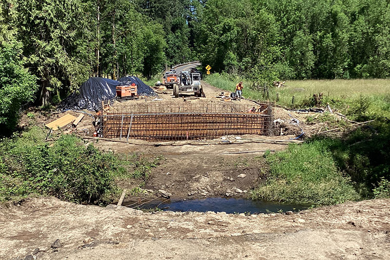
Clackamas County received state funds to replace the existing bridge on Canby-Marquam Highway over Bear Creek.

The existing bridge, built in 1960, was showing signs of decay as a result of heavy truck traffic. The bridge was considered functionally obsolete (narrow) and structurally deficient, with a sufficiency rating of 27.2 out of 100. Temporary repairs  to the timber components until the bridge were made prior to replacement. The asphalt required constant repair due to the bridge vibrating and shaking when trucks travel on the bridge.

Bridge replacement description

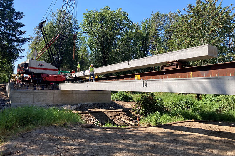
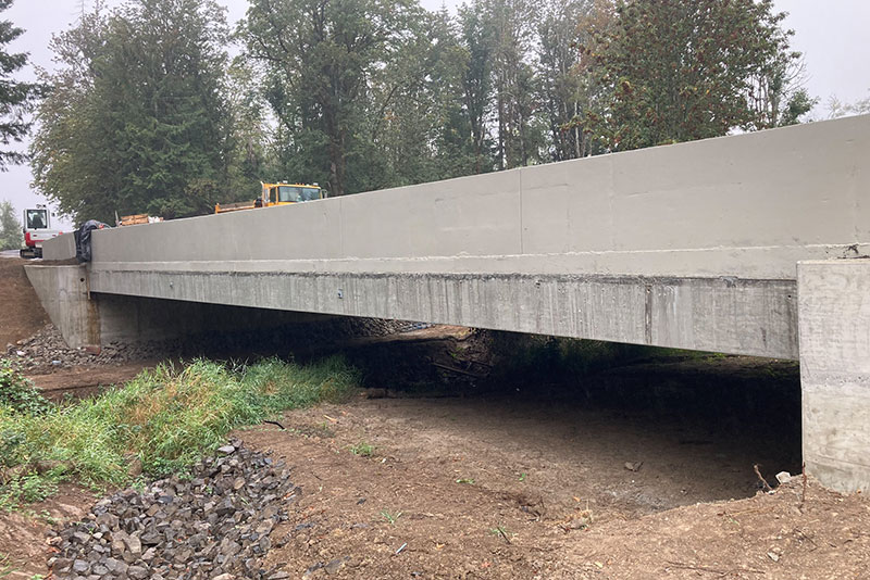
The replacement bridge is a new precast, concrete single-span structure spanning Bear Creek on the current alignment. The new bridge is approximately 83 feet long with a total width of 40 feet (two 12-foot wide lanes, two 6-foot wide shoulders, and two 2-foot wide barrier rails). The bridge is founded on 16-inch diameter steel piles approximately 50 feet deep below ground surface. 

Current activities

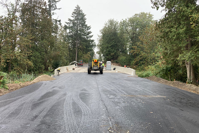
  • Construction is substantially complete. 
  • Temporary road striping placed in Nov. 2022 and permanent striping will be placed in the late spring or early summer 2023.
  • Plants will be monitored quarterly to verify establishment in 2023.
Typical Section
Construction on the bridge, workers using a crane to move things in place
Typical Section
Construction on the bridge, workers using a crane to move things in place
bear creek complete

Engineer

Joel Tubbs, PE (David Evans & Associates)

Contractor

Carter and Company, Inc.

Funding

  • Estimated total project cost: $2.6 million
  • Funded through Local Project Program Funds matched with county road funds
 
Contact
Department Staff
Stan Monte
Construction Project Manager
503-742-4678
Sidebar Heading
Related Information
New Format?
On

Victory Road at Forsythe Road Realignment

An existing intersection at Victory Road and Forsythe Road, south of Cliff View Drive, had limited site distance and experienced periodic crashes. Recent development near the intersection created significant changes. The County and developer previously negotiated an agreement for the developer to dedicate funds and the necessary right of way to realign the road at the intersection and significantly improve the site distance. Nearly 1000 LF of new roadway alignment was constructed, including excavation, pavement, stormwater, guardrail and signing efforts. Additional scope was added to include improvements made along Forsythe Road, including additional embankment, a guardrail run with terminal end pieces, and improvements to the vertical curve in order to close the existing Victory Road's access to Forsythe Road and open a new access approximately 300 feet to the west.

Updated: 12/06/19

Contact: Bob Knorr, Project Manager: rknorr@clackamas.us, 503-742-4680

Engineer: Joel Howie, PE (Clackamas County, DTD Transportation Engineering)

Contractor: Kerr Contractors Oregon, LLC

Funding: Estimated cost to complete the project is $480,198.50, funded by the County in cooperation with the nearby area developer.

Sidebar Heading
Related Information
New Format?
On

Jennings Ave. Improvements: Hwy 99E to Oatfield Road

Improving safety and connectivity for pedestrians, cyclists, and motorists along SE Jennings Ave.

Status: Construction

Updated: June 5, 2025

This project, along SE Jennings Ave. between Highway 99E (McLoughlin Blvd.) and SE Oatfield Road, will help connect residents to nearby businesses and transportation options, and provide safe routes for students to travel to local schools in the area.

 Proposed design for all of SE Jennings Ave. within the project limits.

Roll Map

Schedule

Bids were received and contract was awarded in February 2024 to Emery and Son’s Construction.

  • Project planning and design: Nov. 2019 – Nov. 2023
  • Right of Way Acquisition Efforts: Jan. 2021 – Sept. 2023
    All right of way acquisitions are conducted as required by state and federal law. Read right of way brochure: English | Spanish.
  • Construction: May 2024  – October 2025

Traffic impacts 

  • Work hours: 7 a.m. and 6 p.m., Monday–Friday, and Saturdays as needed.
  • The construction contractor will be concentrating on the McLoughlin Blvd to Addie St while it is closed. Once completed,  construction is planned to start at Addie St and move towards Oatfield Road, followed by paving. 
  • The road will be paved in July/August, striped in September and construction completed by October 2025.
     

Engineer/consultant

Nicholas McMurtrey, PE; Murraysmith, Inc.

Things to be aware of

Traveler Safety FAQs

This section of Jennings Ave. is being considered now because it best fit the criteria for Metro’s Regional Flexible Funds Allocation funding program (a key funding source). It is the appropriate size and had already been identified as a high priority project in the Clackamas County Transportation System plan. 

In 2013, Clackamas County requested funds for this project from Metro’s Regional Flexible Funds Allocation (RFFA) program, a process used by Metro to distribute federal money to local projects. In November 2013, Metro notified the county that they had awarded funds for this project to begin in 2016–2018. Since the project was not fully funded, the county needed to identify additional funding sources. Once additional funding was identified and the county completed the contracting process with the Oregon Department of Transportation, we were able to begin working on the project in 2019. 

Plans for work on other portions of Jennings Ave.

The Clackamas County Transportation System Plan (TSP) includes improvements of bike lanes and sidewalks for the entire length of Jennings Ave. between McLoughlin Road and Webster Road. Project priorities in the TSP were developed with input from the community and adopted by the Board of County Commissioners.

  • The current project between Oatfield and McLoughlin is a Tier 1 (top) priority projects
  • The segments between River Road and Oatfield are identified as Tier 1 (top) priority projects (Project #1068).
  • The segment between Oatfield Road and Webster Road is a Tier 2 (second level) priority project (Project #2021). 

Projects along the other segments of Jennings, both the segment from River Road to Mcloughlin and the segment from Oatfield to Webster, will be constructed when we can get funding for them. We depend on outside funding sources for sidewalk and bike lane improvements and work diligently to match needed projects to funding from state and federal resources.
 

Notices will be sent to area residents and property owners at key points during the process.

Share your comments and ask questions.

Funding

  • Estimated project cost: $8.6 million
  • Funding sources: Oregon Department of Transportation (ODOT), Federal Highway Administration (FWHA) and Clackamas County

Other Resources

Project area
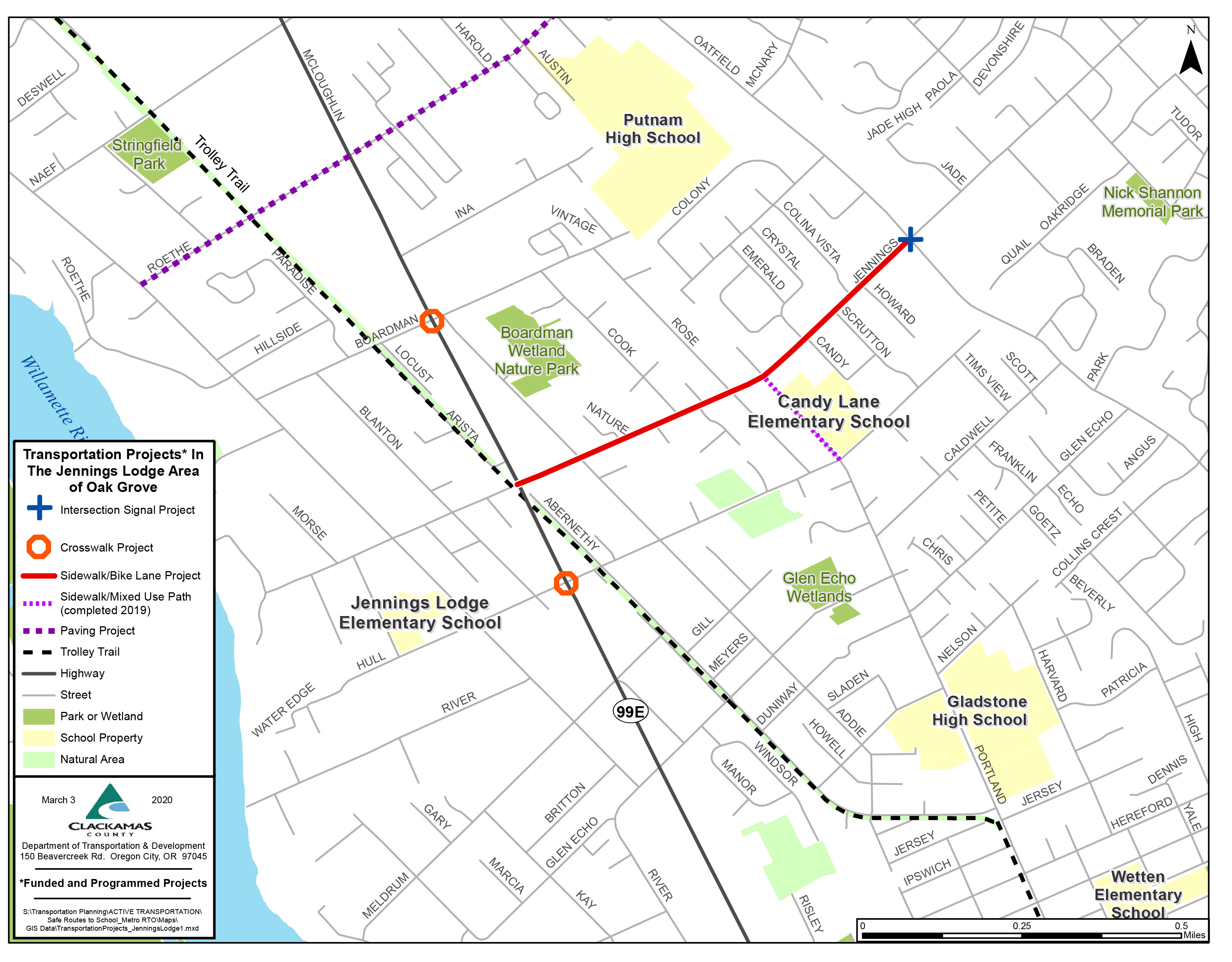
Project Map

Existing conditions

There are many sections of SE Jennings Ave. without sidewalks or bike lanes. Some examples of these incomplete connections that will be completed as part of this project are shown below.

Existing Conditions
Existing Conditions
Existing Conditions


Traffic analysis

FAQ

108361
 
Contact us
Department Staff
Stan Monte
Construction Project Manager
503-742-4678
Sidebar Heading
Related Information
New Format?
On

S. Ivy St. Pedestrian Intersection Improvements

Widening roadway to a consistent three lanes and adding bike lanes and sidewalks on both sides from 99E to Lee Elementary School. A yellow and red flashing signal will also be installed at the intersection of Ivy St and Township Road. Signal will be activated to green-yellow-red phases when future traffic demand warrants signal. Fully accessible curb ramps will be constructed at intersection corners, as well as stormwater facility upgrades that will provide improved drainage for the roadway and treatment of stormwater runoff. 

Status

Construction

Updated: June 25, 2024

South Ivy Street connects downtown Canby to schools, parks, and surrounding residential neighborhoods. As an important connection, it is crucial that this road serve vehicles, bicyclists and pedestrians. Our goal is to construct a complete street, creating a linked network of sidewalks and bike lanes giving bicyclists and pedestrians of all ages access to local businesses, schools, parks, and nearby neighborhoods.

Through a collaborative effort between the community, city and county, multiple alternatives to improve South Ivy Street were evaluated. The final project will safely accommodate existing traffic growth, minimize impacts to adjacent properties and parking, and make South Ivy a more walkable and complete street.

Why

To provide a safe route for bikes and pedestrians along Ivy St. and provide a traffic signal at the intersection of Ivy St. and Township Road. 

Schedule

  • Utility Relocation: July 23 – Spring 2024
  • Design: Sept. 2019 – Jan. 2024
  • Right of way: Nov. 2020 – May 2024
  • Construction: June 2024 – Dec. 2025

Things to be aware of

  • Expect flagging and lane closures for vehicles and bicycles daily during construction between SW 1st Ave (Hwy 99E) and SW 11th Ave. Local access to driveways will be maintained. Pedestrian access will be provided. Please slow down and use caution near the work zone. 
  • Canby Utility is moving power underground and adding street lighting. Expect crews to be onsite through spring 2024. While weekend and night work is not planned, it may be needed for the utility relocation work. Traffic flaggers will direct travelers through lane closures. Please slow down and be mindful in the work zone.  Thank you for your patience as we work to complete this project as quickly and safely as possible.

Funding

  • Project estimate is $7 million
  • Funding is provided from State Funded Local Projects funds, County Road Funds and City of Canby funds. 

June 2021 open house materials

 
Contact us
Department Staff
Jordan Cools
Project Manager
503-742-4654
Sidebar Heading
Related Information
New Format?
On

Trolley Trail Bridge Feasibility Study

Clackamas County is assisting the City of Gladstone, who received federal grant funding from the Regional Flexible Funds Allocation (RFFA), in studying the feasibility and location of constructing a bridge in the abandoned Trolley Trail Bridge crossing of the Clackamas River.

Studying the feasibility of replacing the Trolley Trail Bridge for pedestrians and bicyclists would provide a much-needed active transportation link across the Clackamas River linking the City of Gladstone and Oregon City, and become a signature landmark for the popular Trolley Trail.

Updated : 1/30/20

Current activities: Draft environmental baseline reports are being finalized.

Schedule: The Final Design Concept Alternatives Report was completed in January of 2020. The City of Gladstone received an Active Transportation Grant from Metro to perform the design, engineering and permitting of the replacement bridge. The design is anticipated to start in early 2021

Project impact on traffic: None

Contact: Joel Howie, Project Manager — jhowie@clackamas.us, 503-742-4658

Engineer: Doug Johnson, PE (David Evans & Associates)

Consultant: David Evans & Associates

You might like to know: A meeting was held at the City of Gladstone on 10/31/19 to discuss the feasibility study and the draft bridge concepts.
Presentation

Funding:

  • Estimated cost of the feasibility study: $225,000 ($202,000 approximately from federal RFFA grant)
  • Estimated cost of the design: $1,228,000 ($1,101,884 approximately from federal RFFA grant)
Sidebar Heading
Related Information
New Format?
On

South End Road Landslide Repairs

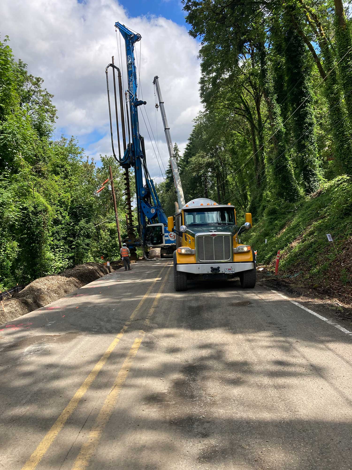
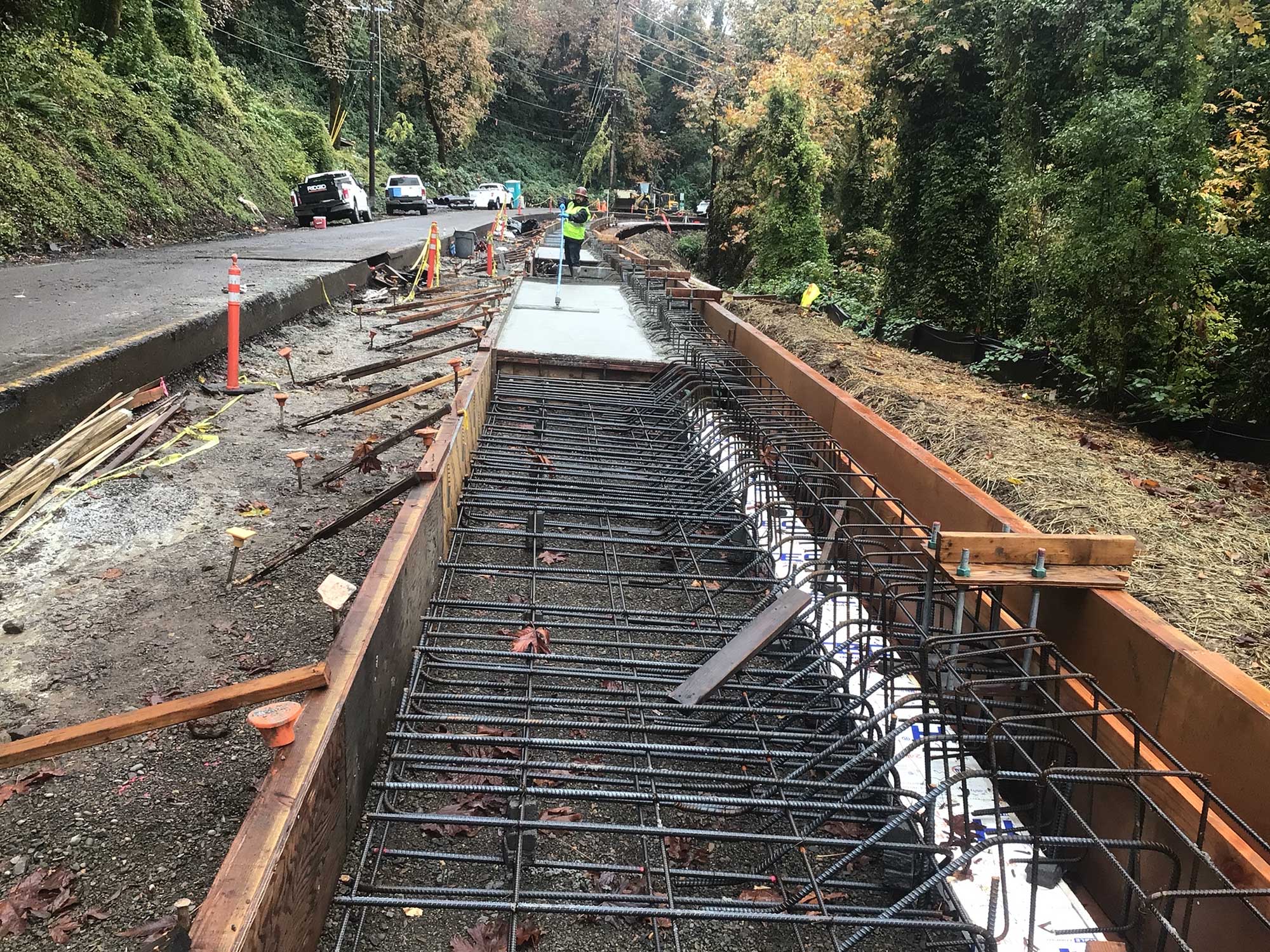
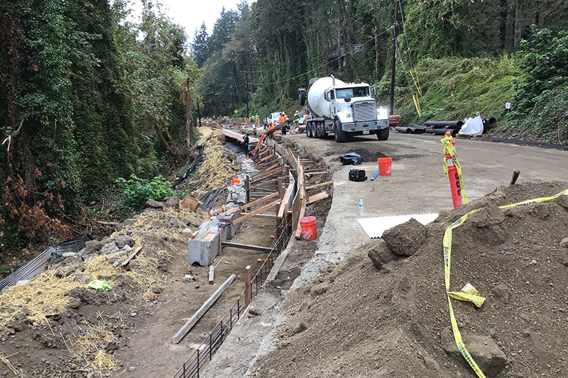
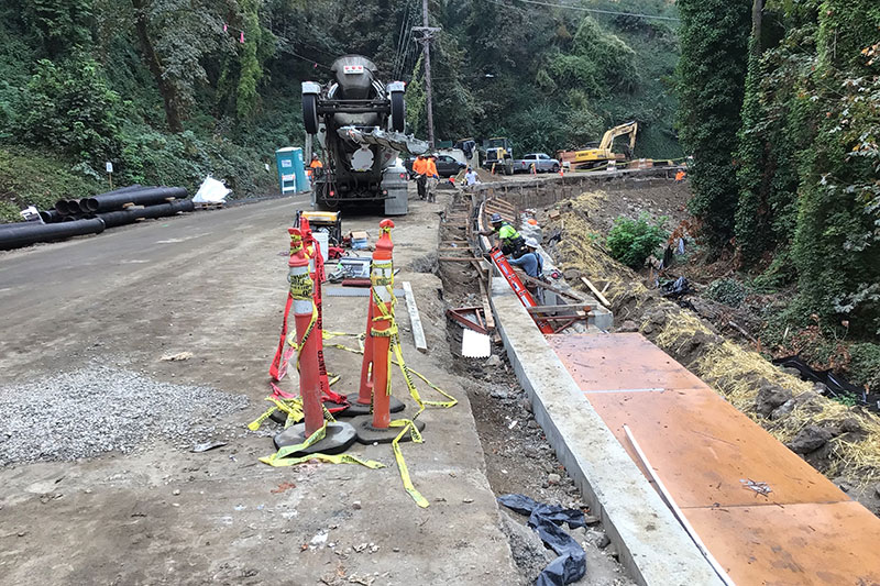
South End Road was damaged in March 2017 as a result of heavy rains. A state emergency declaration, which included Clackamas County, was signed by the governor that allowed Clackamas County to be eligible for the federal funding. Federal Emergency Relief Program (ERP) funds were received to stabilize the roadway and slope on South End Road near Coffee Creek (milepost 3.8).

Status

Updated: Dec. 15, 2022

Clackamas County constructed temporary pavement repairs to these areas in the spring of 2017. Additional geotechnical exploration and surveying defined subsurface conditions and identified solutions to stabilize the slope.

Two types of retaining walls designed to prevent future slide activity will be built on the embankment along the north side of South End Road. A section of the roadway will be reconstructed where cracks have surfaced. Drainage will be improved on the west side of the road to carry water away from the roadway to prevent future damage.

Schedule

Construction is planned through Jan. 31, 2023 to complete construction of the retaining walls, placement of the base lifts of asphalt, installation of trees and shrubs, and temporary striping. The final layer of asphalt and permanent striping will be completed in the spring/summer of 2023. All work is expected to be completed by June of 2023.

Traffic impacts

South End Road will be closed from 7 a.m., April 17 through 6 p.m., April 20, 2023, 24 hours a day. This closure is needed for the final roadway paving near the retaining wall constructed last fall. All traffic will be detoured along Warner-Parrot Road, Linn Ave., 5th St. and High St. 

Final striping work will follow two weeks later and can be done with traffic flaggers, so expect traffic delays up to 20 minutes.

The closure and paving activities depend on dry warm weather. Watch for update closures dates on the project warning signs on South End Road.

Current activities

  • Preparing for final paving and permanent striping

Funding

  • Estimated total project cost: $4.6 million
  • Funded through a federal emergency relief program ($4 million) matched with county road funds ($600,000)

Other Resources

South End work South End Rd Construction South End Road landslide repairs
South End Road landslide repairs

Frequently Asked Questions

91596
Contact
Department Staff
Joel Howie
Project Manager
503-742-4658
Stan Monte
Construction Project Manager
503-742-4678
Sidebar Heading
Related Information
New Format?
Off

Traffic Safety Commission

To promote traffic safety county wide and help develop, review and recommend policies, programs and projects addressing traffic safety. Examples include conducting DUII education at local area schools, supporting a Safe Communities program, reviewing and recommending projects and priorities of safety improvements and other safety expenditures as well as participation in area safety fairs to promote traffic safety.

The Traffic Safety Commission (TSC) is made up of 12 adults and one or more high school students. The TSC focuses on projects and programs in the following areas:

  • alcohol and drugs related to traffic safety
  • codes and laws related to traffic safety
  • driver education
  • highway design, construction and maintenance
  • identification and monitoring of high crash locations
  • pedestrian and bicycle safety
  • traffic data
  • school bus and school zone safety
  • traffic control devices

The Traffic Safety Commission meets the first Wednesday of every other month from 7–9 p.m. in the Development Services Building Room 301, 150 Beavercreek Road, Oregon City or through Zoom. If you would like to join by Zoom, you must first register.

Name of View
No results were found for your search. Please try again.

Commission members

  • Christopher Larsen (chair)
  • Andrew Labonte (vice chair)
  • Robert Biddle
  • Janette DeCastro
  • William Feeley
  • Bob Karl
  • Rafael Kaup
  • Nathan McCarty
  • Patricia Oleson
  • Marchelle Paholsky
  • Michael Wilson
Sidebar Heading
Related Information
New Format?
On

Pedestrian and Bikeway Advisory Committee

Videoconferencing

Attend virtually 
Join this meeting 
Webinar ID: 868 3963 7244 
Phone: 669-444-9171

Committee work has included development of bicycle and pedestrian safety programs, reviewing bicycle and pedestrian project priorities, and completing the county’s Active Transportation Plan. Our goals include:

  • Develop a coordinated system of safe and convenient bikeways and walkways
  • Stimulate public awareness
  • Examine current and future financing options and budget strategies for bicycle and pedestrian projects

The Pedestrian and Bikeway Advisory Committee generally meets on the first Tuesday of every month from 6:30 to 8 p.m. in Room 301 of the Development Services Building, 150 Beavercreek Road in Oregon City.

The Committee is currently meeting remotely via Zoom. 

The public is welcome to attend. Please check the list below for the next meeting.

Name of View
No results were found for your search. Please try again.

Committee Membership

  • David Weber (chair)
  • Joseph Edge (vice-chair)
  • Steve Adams
  • Kelli Grover
  • Dale Guenther
  • Pete Ihrig
  • Emma Lugo
  • Mindy Montecucco
  • Bruce Parker
  • Del Scharffenberg
  • Hans Tschersich
  • Dick Weber
Staff Contacts
Department Staff
Scott Hoelscher
Planner, Senior
503-742-4533
Mya Ganzer
Planner 1
503-742-4520
Sidebar Heading
Related Information
New Format?
On