 Translate


Transportation Engineering
Transportation Engineering
5-year Transportation Capital Improvement Program (CIP)
Clackamas County is responsible for maintaining the integrity and safety of over 1,400 miles of county roads, 186 bridges, and nearly 200 traffic signals. This transportation system represents a $1 billion investment that must be continually maintained and improved to accommodate increasing demands.
The Transportation System Plan includes more than 300 capital transportation improvement projects needed over the next 20 years as defined through two years of public engagement.
The 5-Year Capital Improvement Program includes projects from the transportation system plan scheduled for construction between 2024–2028. These projects are either fully funded or have funds for preliminary planning and design. The capital improvement program includes schedules and funding sources for each project in the five-year plan (pages 9 – 15).
Projects can range from adding a sidewalk paving roads, upgrading traffic signals, adding turn lanes and even replacing bridges.
Of the 86 projects in the five-year capital improvement program estimated to cost approximately $220 million, about $16 million is funded through the Community Road Fund. These projects have been prioritized to improve safety and enhance capacity by upgrading roads, improving bridges and culverts, installing new signal systems and completing major repairs.
Sources of the projects include:
- Transportation System Plan
- Transportation Safety Action Plan
- Community Road Fund prioritization
- Development Agency work program
- Intelligent Transportation System (ITS) Plan, the county's technology upgrade plan for traffic signals
- ADA Transition Plan, the county's plan that identifies barriers that impede access to county roadways for people with disabilities
- The Five-year
- Regular county review and inspection of bridges and culverts
- Other critical work identified through road maintenance and repairs
New Format?
On
The Villages at Mt. Hood Pedestrian and Bikeway Implementation Plan
Plan overview
The project team, working with a Public Advisory Committee (PAC) and a Technical Advisory Committee (TAC), analyzed current walking and bicycling conditions in order to:
- Identify bicycle and pedestrian needs within The Villages at Mt. Hood
- Develop a Safe Routes to School Plan for Welches Elementary and Middle School
- Identify potential locations for additional or enhanced US 26 pedestrian crossings, including at-grade and grade-separated solutions, or enhancements to current crossings
- Evaluate the feasibility of a multi-use path in the area
Funding
The County received a Transportation and Growth Management (TGM) grant from the Oregon Department of Transportation (ODOT) to create the Plan.
Safe Routes to Schools
As part of the Walk & Bike The Villages at Mt. Hood Plan, Clackamas County worked with community and school leaders to create a Safe Routes to School plan for Welches Elementary and Middle School. The plan examines conditions around the school and recommends solutions to improve safety and accessibility. The plan will create safer and more inviting opportunities for students and their families to walk and bicycle to school. Review the Safe Routes to School plan and Infrastructure projects plan.
Public participation
A 9-member Public Advisory Committee (PAC) was created to review materials and provide input and advice. The PAC met 3 times during the plan development and included community members and representatives from various groups, e.g. Sandy River Watershed Council, Rhododendron CPO, Mt. Hood Chamber, etc. An 8-member Technical Advisory Committee (TAC) met 4 times and helped inform decisions related to traffic engineering, bicycle and pedestrian designs, etc. Public participation also included 2 open houses to give community members an opportunity to provide input on the Villages plan and recommended project solutions. About 29 to 39 people attended the first and second open house respectively. Attendees provided their feedback on such topics as pedestrian and bicycle needs, signage needs, traffic concerns, and recommended solutions and projects to improve access to transit and to multiple destinations including businesses, residences, Welches school, Post Office, etc. Public participation also included an online open house held for several weeks, news releases, articles in Citizen News, and postings to the project website. View the Community Outreach and Engagement Plan.
Contact: Scott Hoelscher, Project Manager, scotthoe@clackamas.us, 503-742-4524
Updated: 6/8/17
New Format?
On
Roadway Standards
These Roadway Standards provide the criteria for design and construction of roadways, accesses, site development and integrated drainage facilities under the jurisdiction of Clackamas County.
Clackamas County is interested in comments and suggestions for improvements to the Roadway Standards. Please contact us at engineering@clackamas.us or 503-742-4691 with suggestions or questions or to obtain the Standard Drawings in AutoCAD (dwg) format.
Roadway Standards Updated June 2020
Standard Drawings, updated June 2020
- C100 Street Structural Section
- C110 Local/Connector Roadway Section
- C130 Collector Roadway Section
- C140 Arterial Roadway Section
- C200 Temporary Turnaround
- C220 Passenger Vehicle Turnaround
- C300 Standard Cul-de-sac Local Road
- C350 Truck Turnarounds & Turnouts for Public/Private Road & Driveways
- C400 Alternative Horizontal Curves for Very Low Volume Roads (<400 ADT)
- D250 Typical Plan for Driveway Culvert Installation
- D400 Standard Driveway Entry onto Unpaved County Roads
- D500 Standard Driveway Entry onto Paved County Road with No Curbs
- D600 Standard Driveway to Curbed County Roads with No Landscape Strip
- D650 Standard Driveway to Curbed County Roads with Landscape Strip
- D675 Alternative High Volume Driveway with Curbs
- D700 Driveway Water Bar (Berm) Construction
- L100 Tree Planting Details
- L200 Street Tree Location
- M100 Monument Box Less Than 35 MPH
- M150 Monument Box Greater Than 35 MPH
- N100 Standard Notes - General
- N200 Standard Notes - General (cont) & Grading
- N300 Standard Notes - Street, Storm & Utility
- P100 Parking and Aisle Layout Details (9' x 18')
- P200 Parking and Aisle Layout Details (8.5' x 16')
- R100 Private Roads & Driveways - Minimum Standards
- S100 Standard Type C Vertical Curb & Curb Details
- S150 Standard Curb and Gutter
- S180 Mountable Curb
- S960 Standard Sidewalk & Curbed Ramp Notes & Details
- T100 Street Name Signs & Details
- T130 Street Name Signs and Details (continued)
- T150 Street Mounting and Attachments
- T250 Sign Installations
- T300 Horizontal Sight Distance Along County Roadways
- T350 Type III Barricade End of Road
- U100 Underground Utility Placement Zones
- U200 Standard Trench and Backfill
- U250A Standard Trench with Controlled Density Backfill (CDF)
- U250B Notes for U250A
- U270A Alternative Trench with Controlled Density Backfill
- U270B Notes for U270A
- U275 Pavement Cut Standard Arterial/Collector Roads
- U280 Pavement Cut Standard Connector/Local Road
- U290 Pavement Cut Standard Multiple Trenches
- U295A Utility Pothole Repair Standards
- U295B Notes for U295A
Associated Documents
- Certificate of Compliance and Completion
- Clackamas County Street Tree List
- Developer - Engineer Agreement
- Design Modification form
- Entrance Permit Matrix
- Mailbox Installation Standards
- Shrub, Groundcover, Riparian Plant List
ADA (Americans with Disabilities Act) Checklists
New Format?
On
Glossary of Transportation Terms
Road Classifications
alley: an alley provides access to the rear of properties and may be public or private. Alleys should intersect local roads or connectors. Alleys are not for through traffic.
city streets: similar to County roads, except under the jurisdiction of a city.
collector: a road that is a principal carrier within neighborhoods or single land use areas. Collectors link neighborhoods with major activity centers, other neighborhoods and arterials and are generally not for through traffic. They carry low-to-moderate volumes of traffic at low-to-moderate speeds. New collectors should intersect minor arterials rather than major arterials. Examples:
Hill Road, Aldercrest Road, Howard's Mill Road
connector: a road that collects traffic from and distributes traffic to local streets within neighborhoods or industrial districts. Connectors are usually longer than local streets and carry low volumes of traffic at low speeds. Connectors primarily serve access and local circulation functions, and are not for through traffic. Traffic calming measures may be appropriate. A connector should connect to a collector or minor arterial. Examples: Oregon Trail Dr.; Sieben Creek Dr.
county roads: Public roads for which the Clackamas County Board of Commissioners has accepted maintenance responsibility.
functional classification: categorizing roads based on the type of service provided: freeway/expressway, major arterial, minor arterial, collector, connector or local road.
freeway/expressway: a highway that serves inter-regional and intra-regional trips, and carries heavy volumes of traffic at high speeds. Examples: I-205; the Milwaukie Expressway (Oregon Highway 224)
interstate highways: multi-lane federal highway that provides connections to major cities, regions of the state and other states. Interstate highways are major freight routes. Maintenance responsibilities belong to the Oregon Department of Transportation. There are two interstate highways in Clackamas County: I-5 and I-205.
jurisdictional classifications: a classification of roads based on ownership of the road.
local: a road designed to provide access to abutting property and to connect to higher order roads. New local roads should intersect connectors, collectors or, if necessary, minor arterials. Traffic calming measures may be appropriate. Local roads are inappropriate for through traffic.
major arterial: a road that primarily carries local and through traffic to and from destinations outside local communities; connects cities and rural centers, and carries moderate-to-heavy volumes of traffic at moderate-to-high speeds. Examples: Sunnyside Road, Boones Ferry Road
minor arterial: a road that primarily connects collectors to higher order roadways, and carries moderate volumes of traffic at moderate speeds. Examples: Oatfield Road, Beavercreek Road, Borland Road
private roads: roads owned by a private property owner. Public access and use is by permission of the property owner.
public roads: roads owned by the county or on a county easement that are not maintained by the county; maintenance responsibility lies with abutting property owners.
state highways: state-owned roads that provide the primary connections to larger urban areas, ports and major recreational areas that are not directly served by interstate highways. Maintenance responsibilities belong to the Oregon Department of Transportation. Examples in Clackamas County: Oregon Highway 213, Oregon Highway 224, Oregon Highway 99E
Design/Engineering Terms
capacity: the maximum rate at which persons or vehicles can be reasonably expected to traverse a point or uniform segment of a lane or roadway during a specified time period under prevailing roadway, traffic and control conditions; usually referred to as vehicles per hour or persons per hour. This is the standard used to determine when additional lanes need to be added.
centerline miles: miles of roadway measured without regard to the number of lanes or functional classification of the road.
design standards: those conditions that should be met when a new road is constructed or when a deficient section is improved. Standards include all relevant geometric and structural features required to provide a desired level of service over the life of the project — generally 20 years beyond completion.
frontage road: a road that parallels the interstate to relieve traffic congestion caused by local trips.
interchange: a highway intersection allowing traffic to move freely from one road to another without crossing another lane of traffic.
level of service: a qualitative measure of traffic conditions generally described as speed and travel time, freedom to maneuver, traffic interruptions, comfort and convenience, and safety.
overpass: an elevated roadway that crosses over another thoroughfare.
right-of-way: the property for infrastructure including travel lanes, parking, bikeways, sidewalks, utilities, shoulders, etc.
Funding Terms
distribution formula: refers to the statutorily defined formula for allocating state motor fuel tax revenues to specific programs and entities.
system development charges: Fees collected when a permit for any new development is issued. These fees finance transportation capacity improvements, including stop lights, traffic signals, new lanes and new roads. These funds may not be used for maintenance.
Tax Increment Financing (TIF): Revenues generated by new growth within specified areas designated are urban renewal districts; used to construct capital improvements that solve transportation problems within the same areas.
Transportation Equity Act for the 21st Century (TEA-21): The 1998 federal transportation funding legislation that provided an emphasis on protecting the environment and reducing congestion, relying on the most efficient transportation mode, and providing increased flexibility to state and local governments on the use of federal funds.
Environmental Terms
Endangered Species Act (ESA): a 1973 act of Congress that seeks to protect various species of fish, wildlife and plants that have the potential of being rendered extinct as a consequence of growth without adequate conservation. The ESA is concerned with "species that are of aesthetic, ecological, educational, historical, and scientific value to this nation and its people." Fourteen varieties of salmon and steelhead have been listed in this region. Once a species is listed, no one may "take" it (harass, harm, pursue, hunt, shoot, wound, kill, trap, capture, or collect, or attempt to engage in such conduct) without a permit. Federal agencies are required to ensure that any federal action, such as constructing a highway, is not likely to jeopardize the continued existence of a listed species or adversely modify critical habitat. Road projects that traverse critical habitat must be reviewed for their impacts on listed species.
in-water work period: a window of time in which construction is allowed within the banks of a stream or river, as specified by the ESA, when the water level is at its lowest and it is the least disruptive time for fish. Example: July 1– Sept. 30 is the in-water work period for Mt. Scott Creek.
riparian area: the banks of a river or stream.
Wetland: a lowland area, such as a marsh or swamp, saturated with moisture. A natural wildlife habitat.
Maintenance Terms
chip seal: a sprayed-on application of an asphaltic emulsion, with a thin layer of aggregate spread over an existing surface. The emulsion improves or restores the waterproof condition of the old pavement surface and arrests any scuffing or raveling. The addition of a cover of aggregate over the sprayed-on emulsion restores and improves skid resistance.
cold mix: see Pugg Mix below.
contract overlays: work completed by private contractors when pavement rehabilitation is beyond routine maintenance. Rehabilitation activities include hot and cold recycling, structural overlays and reconstruction. Rehabilitation is intended to salvage, strengthen and modernize badly deteriorated pavement. Contract overlays and rehabilitation should provide for an additional 10–20 years of serviceability at reduced maintenance costs.
maintenance overlays: a process of applying hot asphaltic concrete to an average depth of 1 1/2 inches to create a new, smoother driving surface.
pavement structure: The combination of subbase, base, base course and surface course placed on a subgrade to support the traffic load and distribute it to the road bed.
pugg mix: Sometimes called cold mix, emulsified asphalt is mixed with aggregate at a site near the road to be resurfaced. Open-graded cold mix cures more slowly than hot asphaltic concrete and generally requires a load limit for a short period. A chip seal is often placed as a wearing surface. Where there may be turning movements or other special needs, the softer open-graded cold mix may be replaced with hot mix in critical sections.
reconstruction: Complete road reconstruction (i.e., remove and replace existing pavement) on essentially the present alignment for distance of at least 0.3 miles.
resurfacing, including shoulder improvements: adding an overlay in excess of 3/4 inch, plus appropriate improvements to shoulders such as adding material to bring them up to grade, widening or reconstructing shoulders.
routine maintenance: Includes all operating and maintenance activities that are conducted on a frequent and ongoing basis (e.g., cleaning and shaping drainage facilities, operating and replacing traffic control devices, maintaining roadside facilities, street sweeping, snow and ice control, grading unpaved roads, emergency pothole patching, and pavement joint sealing and skin patching).
Bridge Programs
bridge improvement: Major rehabilitation and strengthening and/or replacement of existing structures undertaken independently of improvements to the roadway.
bridge rehabilitation: Involves major structural modifications to an existing bridge including widening, substructure repair, superstructure strengthening, deck replacement or rehabilitation, and rail improvement.
New Format?
On
Transportation System Development Charges (TSDC)
TSDCs are one-time fees assessed on new or expanded developments in unincorporated Clackamas County.
These fees are based on the number of vehicle trips a specific land use generates and are intended to help fund transportation facilities needed to support the new or expanded development and its users.
TSDCs in unincorporated Clackamas County
- Fees
- Installment Plan
- Methodology
- Ordinance
- Reductions for Station Area and Mixed-Use Developments
- Residential permits
- Statement of use
- TSDC Credit Eligibility Flowchart
- TSDC Overview
Overview
A TSDC may be included in the final calculation of building permit fees for residential and commercial projects, if applicable.
- New single-family residence, accessory dwelling unit (ADUs) and manufactured homes are assessed a TSDC.
- Replacement dwellings are not assessed a TSDC; a replacement dwelling agreement may be required to confirm prior residence.
- Residential accessory structures (e.g., garages, shops) are not assessed a TSDC.
- A guest home, as defined by ordinance, are not assessed a TSDC.
For more information or questions, please submit your request using the DTD-Transportation SDC by email at dtdtranssdc@clackamas.us or in person at Clackamas County’s Transportation Engineering Department on the third floor of the Development Services Building, 150 Beavercreek Road, Oregon City, OR 97045.
Residential permits
TSDCs for new or expanded residential dwellings are as follows:
| Type of development | TSDC per unit |
|---|---|
| Apartment | $3,237/dwelling unit |
| Mobile Home in Park | $2,429/space |
| Condo/Duplex/Triplex/Quadplex/Townhouse | $2,828/dwelling unit |
| Small Accessory Dwelling Unit (200–449 square feet) | $1,414/ dwelling unit |
| Large Accessory Dwelling Unit (450–900 square feet) | $2,829/ dwelling unit |
| Small Detached Single-Family Home (dwelling units 1,699 square feet or less) | $4,053/dwelling unit |
| Medium Detached Single-Family Home (dwelling units 1,700–3,000 square feet) | $4,622/dwelling unit |
| Large Detached Single-Family Home (dwelling units more than 3,000 square feet) | $4,886/ dwelling unit |
Commercial Permits/Statement of Use form
All commercial permits (including new uses, change of occupancy and tenant improvements) must include a completed Statement of Use form. The Engineering Division will review before the permit is issued so that any applicable TSDC rates can be determined. TSDC rates vary depending on the by structure; this form helps clarify the proposed development and prior use of the space.
You may submit your completed Statement of Use form to the Engineering Division:
- by email at dtdtranssdc@clackamas.us
- in person or by mail to the third floor permits lobby in the Development Services Building, 150 Beavercreek Road, Oregon City, OR 97045.
Parks System Development Charges (PSDC)
Parks System Development Charges are one-time fees charged to new development or significant redevelopment to help pay a portion of the increased cost to meet parks and recreation needs created by such growth. PSDC fees are set by the North Clackamas Parks & Recreation District (NCPRD) based on the specific impact a development inside NCPRD boundaries is expected to have on the District's population and employment.
- Definitions of these SIC Industry Classifications
- Park System Development Charge Informational Handout
Other Fees
New Format?
On
Bikes and Pedestrians
 The county strives to create a complete transportation network where walking and biking are safe, convenient and comfortable ways of moving around the county. We prepare plans and implement projects that support bicycling and walking as viable forms of transportation.
Clackamas County is the only county in the state recognized by the League of American Bicyclists Bike Friendly Communities Program. You can find details about the County’s Bronze Award here.
Bike repair station and custom bike racks installed on Trolley Trail in downtown Oak Grove
The repair station includes all the tools necessary to perform basic bike repairs and maintenance. Screwdrivers, Allen wrenches and box wrenches are provided so that cyclists can change a flat tire, adjust brakes and put air in tires.
Resources for Walking and Biking in Clackamas County
- To report debris or a problem with a bike lane, call 503-557-6391 between 8 a.m. and 5:30 p.m. or use the online reporting system here.
- The Pedestrian and Bikeway Advisory Committee generally meets the first Tuesday of every month, and the public is welcome to attend. Check website for periodic schedule changes and meeting cancellations.
- Clackamas County Tourism has information about recreational biking.
- Metro’s Bike There! Map is a great resource for riding around Clackamas County and the region.
New Format?
On
Transportation Engineering Construction Projects
The county delivers construction projects on major roads in Clackamas County intended to protect the health of the public, maintain a reliable transportation system, reduce congestion and improve safety for all roadway users. These transportation projects will help meet the needs of residents, businesses and visitors throughout the county so they can safely and efficiently connect with goods, services, employment and people.
City and state transportation projects are active within Clackamas County as well. Visit your city website for local projects. Visit the Oregon Department of Transportation for state projects (Region 1: Portland Metro covers most of Clackamas County; Region 2: Northwest Oregon covers a portion of western Clackamas County).
Construction in Progress or Planned for 2026
- 82nd Dr/Jennifer St traffic signal replacement
- Badger Creek (Rugg Road) Culvert Repair
- Beavercreek Road and Barlow Road radar sign installation
- Bilquist Elementary Sidewalks
- Bluff Road/327th Ave. Intersection Enhancements
- Canby-Marquam Hwy Safety Improvements
- El Camino Way Stormwater Improvements
- Henry Creek (Arlie Mitchell Road) Culvert Replacement
- Ivy St. Pedestrian Intersection Improvements
- Jennings Ave Improvements (Hwy 99E to Oatfield Road)
- Johnson Creek Blvd. paving and curb ramps
- Johnson Creek Blvd. (79th Pl. to 82nd Ave.) Intersection Improvements
- Knights Bridge Road/Arndt Road intersection safety improvements
- Leland-Beavercreek-Kamrath Intersection Improvements
- Monroe St Neighborhood Improvements
- Oatfield Blvd/Jennings Ave Traffic Signal Improvements
- Regional Traffic Signal Upgrades
- Rainbow Road (Eagle Creek) bridge scour repairs
- School Beacon Upgrades
- Stafford Road (Pattulo Way to Rosemont Road) Improvements
Construction Planned for 2027 and beyond
- 172nd Ave. Widening and Infrastructure Improvements
- Abernethy Creek (Holly Ln) Bridge Replacement
- Airport Road/Miley Road intersection improvements
- Amisigger Road at Hwy 224 Intersection Improvement
- Bear Creek Bridge Replacement and Molalla Ave Shoulders Improvement
- Bull Run River (Bull Run Road) Bridge Replacement
- Canby Ferry Ramp Improvements
- Clackamas River (Trolley Trail) Preliminary Design
- Conway Creek (Aschoff Road) Culvert Replacement
- Courtney Ave. Complete Streets
- Duus Road/Eagle Creek Road Intersection Relocation and Turn Lane Improvements
- Stafford-65th-Elligsen Roundabout
- Welches Road (Hwy 26 to Birdie Lane) Pedestrian Improvements
Completed Projects
Additional Information
New Format?
On
Clackamas County Bicycle Map
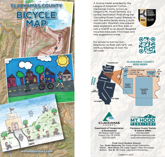 The Clackamas County Bicycle Map has lots of information to help bicyclists pick the best routes, whether for work or recreation, including:
- bike lanes and paved multi-use paths
- roadways, divided into four categories based on suitability for bicycles to share with vehicles — most suitable, moderately suitable, less suitable and difficult connection
- hard-surfaced roads and gravel roads in Mt. Hood National Forest
- single-track and double-track mountain bike trails
The map also highlights 7 suggested recreational bike rides, from seven to 72 miles long, from relatively flat farmland to uphill all the way. Each ride has its own map, ride summary, and elevation profile.
The free, printed Bicycle Map is available at the Clackamas County Development Services Building, 150 Beavercreek Road, Oregon City – 3rd Floor Engineering Division.
New Format?
On